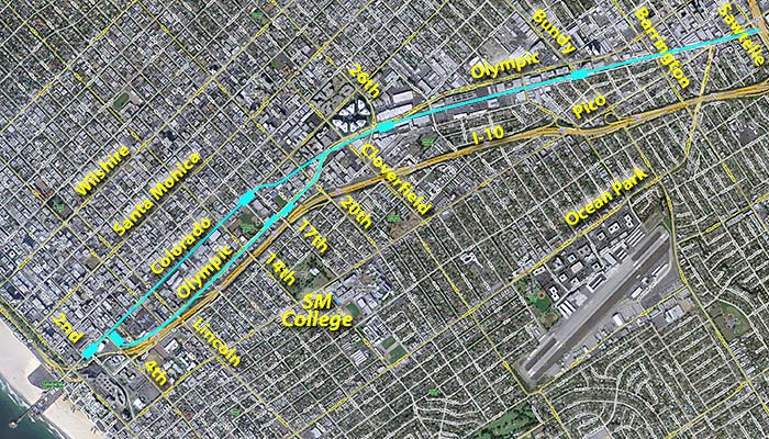
West L.A.-Santa Monica
Traffic Expo Line Light Rail Population Criteria Neighbors
Phase 1 Phase 2 Right-of-way Venice-Sepulveda West LA-Santa Monica
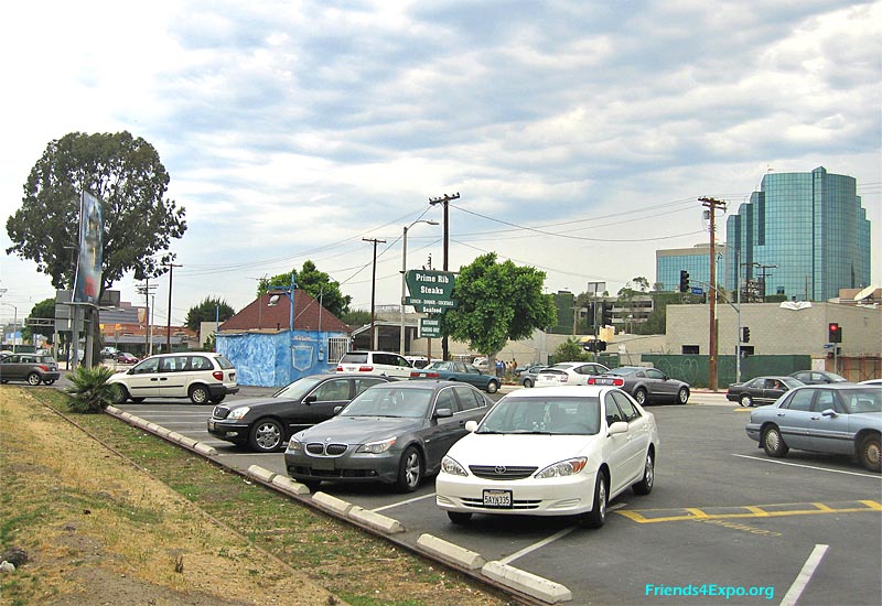 |
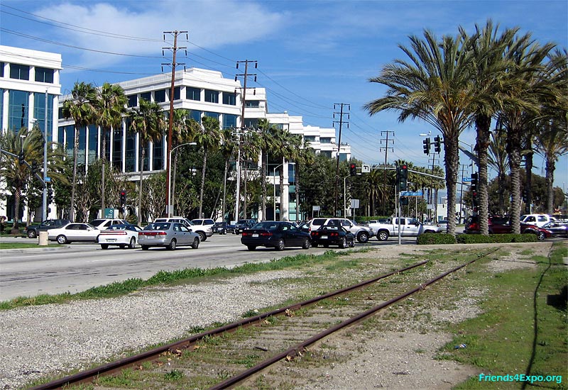
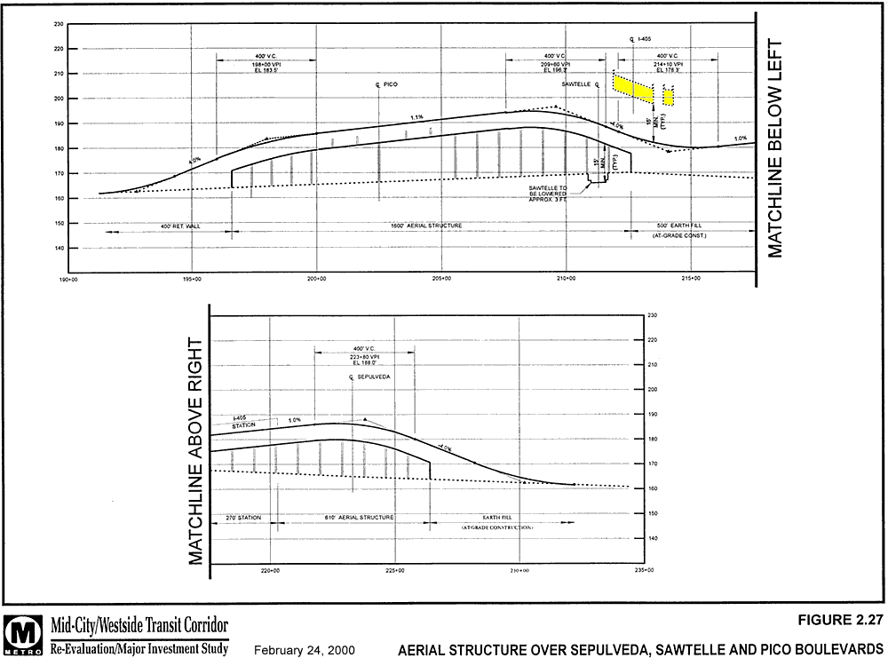
Just west of I-405 the right-of-way forms a triangle west of Sawtelle and south of Pico. The tall building on the right is two blocks north in the Olympic business corridor. Tracks will bridge over both boulevards here and still fit below the I-405 bridge (yellow). (click images to enlarge) Updated 2/21/09 |
 |
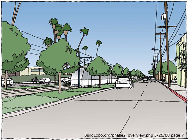
Severe traffic on Bundy calls for a bridge with aerial station here. Note the bike path (in enlarged image) and potential parking along the 100-foot-wide right-of-way The adjacent crossings of Barrington and Centinela would be at-grade, with lanes added to mitigate traffic effects. |
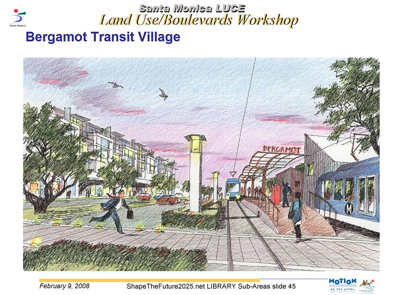 |
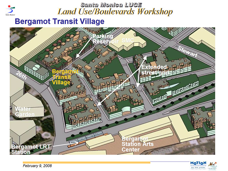
The City of Santa Monica's current General Plan Land Use and Circulation Update is planning for mixed-use "Transit Villages" around the proposed Expo Line stations at 26th and 17th Streets. This sketch shows Bergamot Station on the south side of Olympic, east of 26th, looking east, new housing on the left. |
 |
Santa Monica's Water Garden office complex is across Olympic Blvd. from the line. Cloverfield and Olympic are proposed for grade separations. |
 |
There are two options west of Cloverfield. One would follow the median of Olympic, then go aerial along the north side of the I-10 freeway from 11th to its terminus at 4th and Colorado. But it would conflict with the landmark coral trees. Both options propose a third station at 17th Street to serve the mid-city area, Santa Monica College to the south, Santa Monica-UCLA Medical Center to the north, and a new Transit Village around Memorial Park. |
|
|
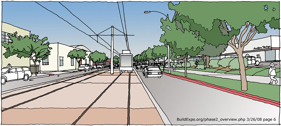
The City of Santa Monica requested a second option, continuing on the right-of-way to 17th, then following the median of Colorado to downtown. Its staff report notes, “On-grade light rail corridors provide greater opportunities over time for retail businesses, enhanced pedestrian environments and walkable connections to the neighborhoods.” |
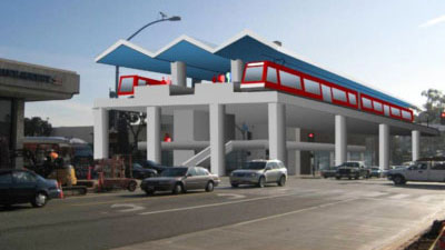 |
The Santa Monica terminus station will replace the Sears Automotive Center on the southeast corner of 4th and Colorado. It would be 35-foot-tall aerial (City of Santa Monica image, left) for Olympic or pedestrian-scale at-grade for Colorado. On Colorado, west of 4th, was too tight between Sears and Santa Monica Place. See Images from Draft EIR (Ch3-Sec3) and Maps of proposed Santa Monica stations. |
|
Summary of proposed street crossings and stations I-405 to Olympic Olympic option Colorado option |
|